___Moonracer Farm OTRA
  • MRF OTRA Blog
  • Moonracer Farm OTRA
  • Capitols Visited
  • Contact Us

New Orleans to Space Center Houston

1/30/2023

0 Comments

 
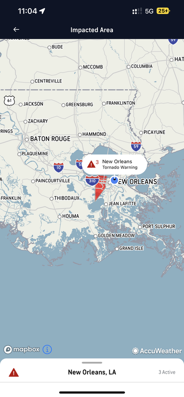
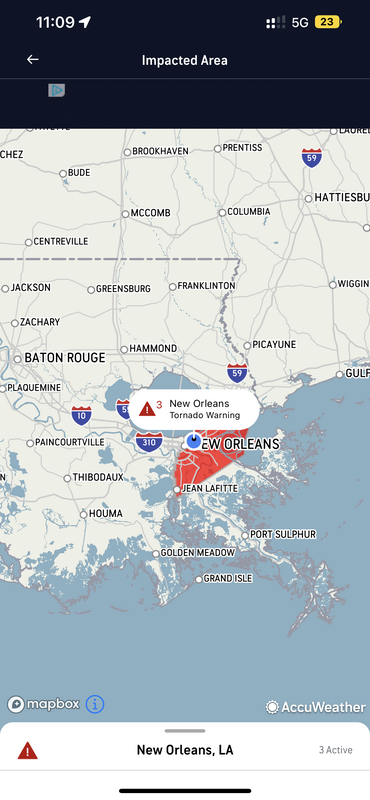
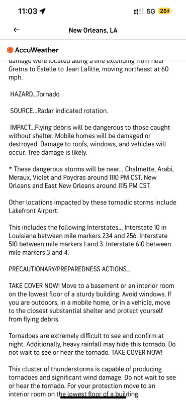
We survived the night of storms, and might have slept through it had we not had the tornado warnings blaring from our phones. In case you haven’t heard it, the severe weather warning on a cell phone sounds like the prison klaxons that warn of a jailbreak; there’s no sleeping through that.  Because we couldn’t even hear ourselves talk between the wind and the rain on the camper’s metal shell, we just watched on our phones as the tornado warnings passed us, and when we were out of the red zone and no longer at risk of being jarred awake again, we went back to sleep.
Picture
Picture
Picture
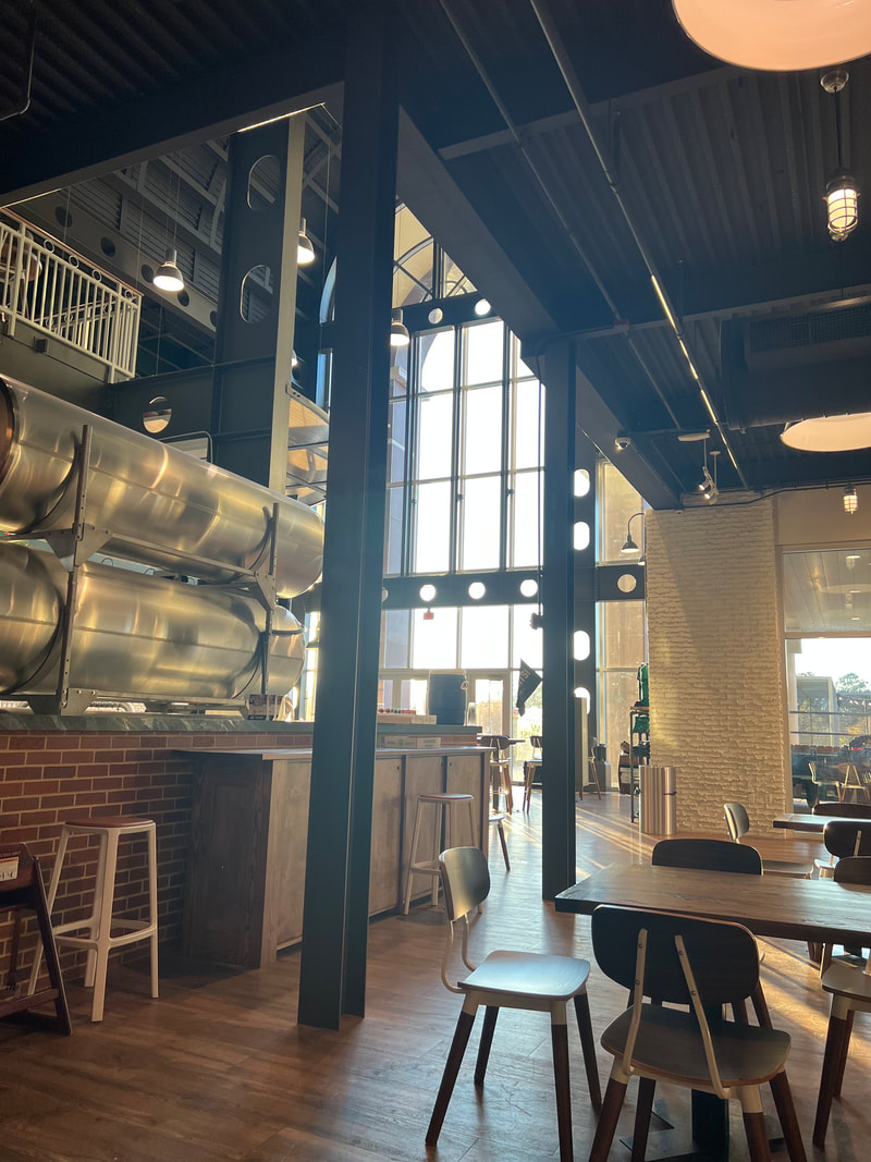
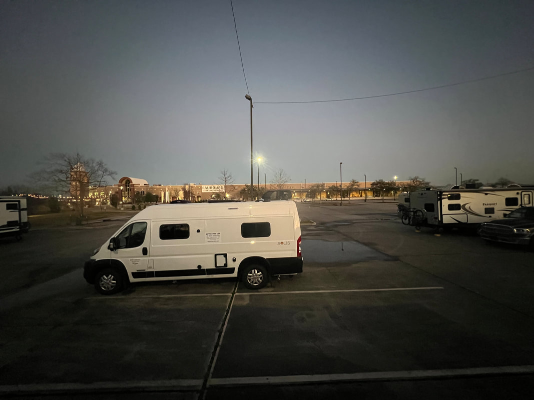
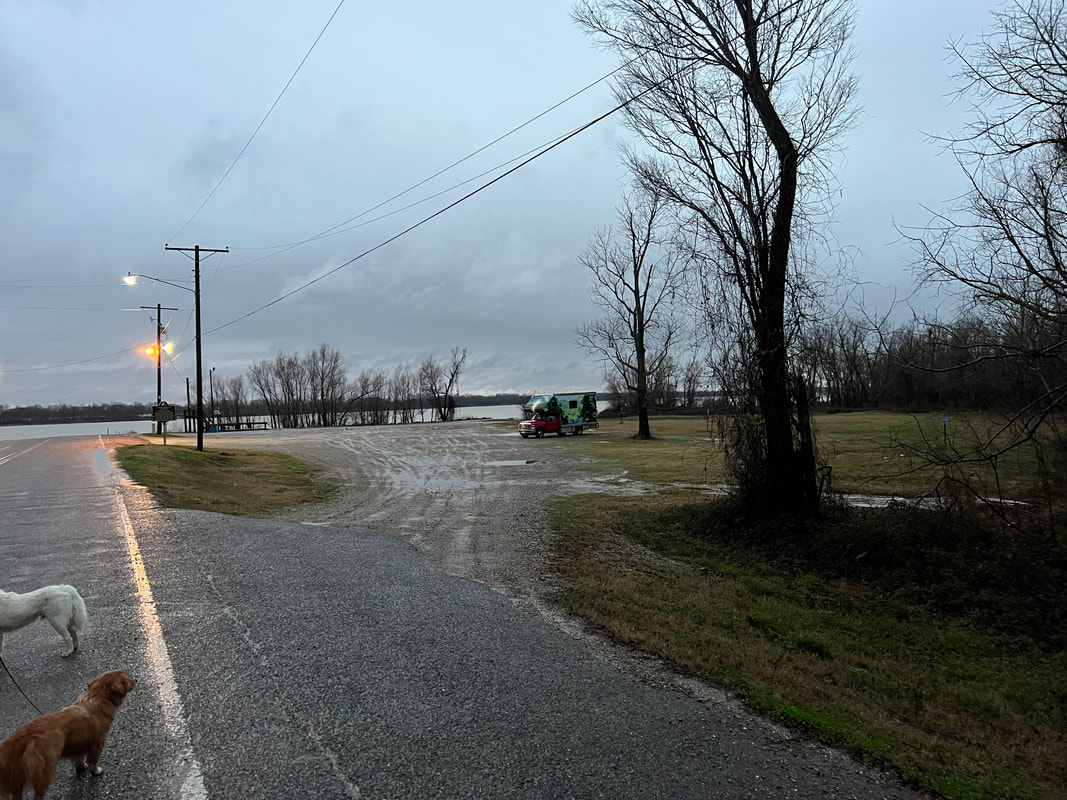
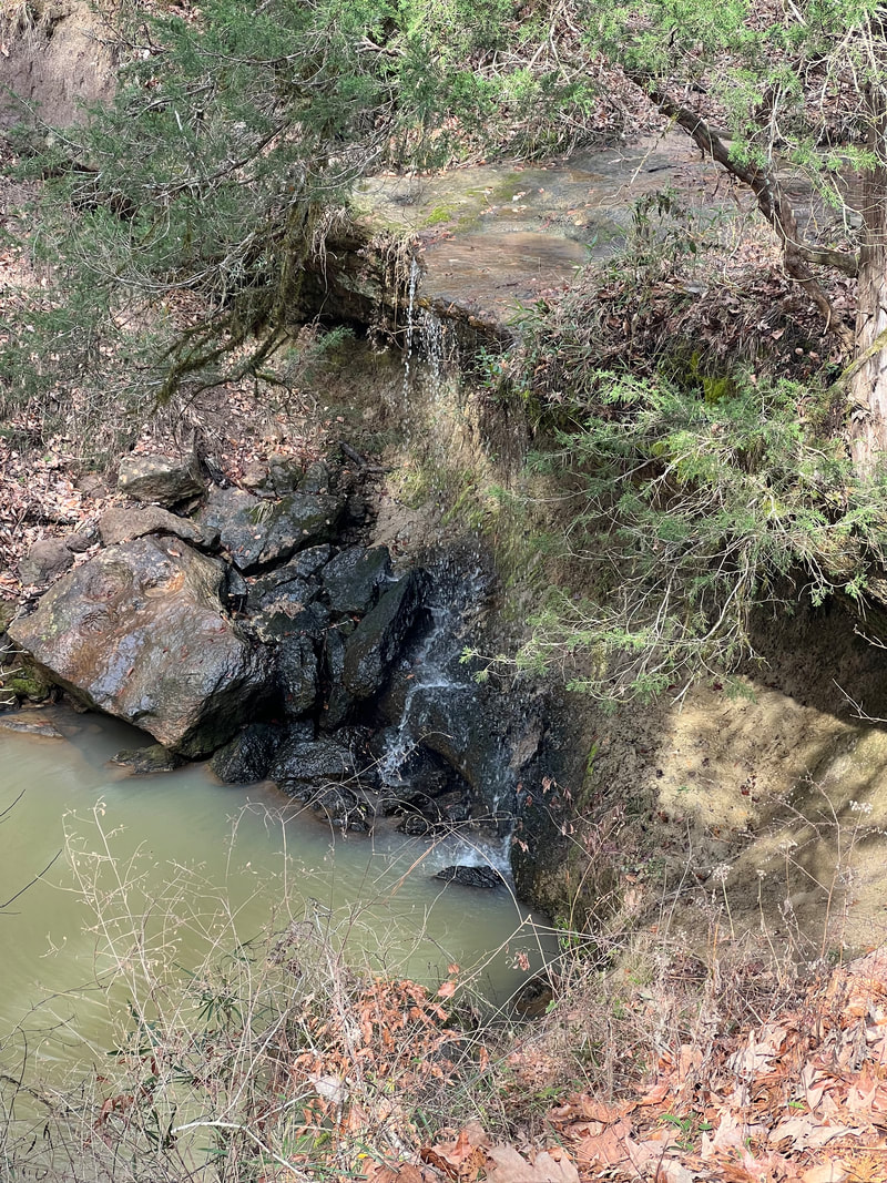
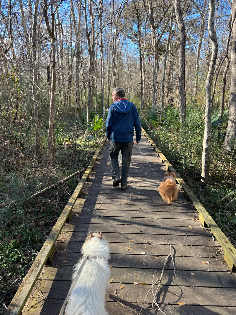
In the morning, when it looked like we were clear to travel, we decided to head towards Texas.  We didn’t really have a route planned as we headed west, but since the storm front had brought cooler temperatures, we decided to head basically south.  Our next planned stop was Space Center Houston, which we knew we couldn’t do in a day, so we stopped for a hike at the Acadiana Nature Station Park in Lafayette, LA.  Due to the rains the night before we couldn’t take the hike we’d planned from the trail map, but the park had plenty of boardwalks and canal paths so we got a good 4-mile walk in before heading for a Walmart in Jennings, LA, which is about mid way between Lafayette and Lake Charles.  We heard the same I-10 traffic at the Walmart as we’d heard at the brewery, although the brewery was still better since Walmart doesn’t have crawfish poutine.
Picture
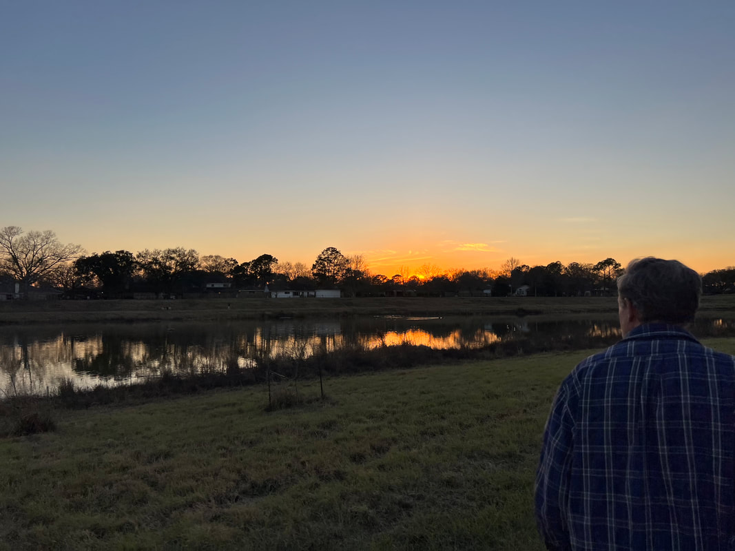
We left the Walmart fairly early and headed for the Space Center.  I’d found a city park with hiking very near the Space Center on All Trails, so that was our goal.  We did a drive by of the Space Center before heading to the park, which was a really nice cement trail loop around a series of small lakes in the middle of the city neighborhood.  Since Houston had suffered even more from the storm than Louisiana, the cement trail was a very nice thing, and it was also very nice to see all the people out walking, with and without dogs, on a pleasant evening.  We finished our walk and headed for a Cabela’s about six miles away, where we spent a quiet night before heading for the Space Center in the morning after another morning walk around the park.
Picture
Tom and I were both really happy we decided to visit the Space Center.  We were there shortly after it opened, and stayed all day.  Everyone we had talked to had given it rave reviews, but having been to Kennedy Space Center in Florida where the rockets are launched, we weren’t sure how interesting a space center in the middle of a city would be.  As it turned out, it was very interesting.  It may have helped that we were there on the anniversary of the Apollo I tragedy, and one day before the anniversary  of the Challenger tragedy, and just a week or so before the Columbia tragedy, so the theme of the day among the tour guides was how much actual sacrifice is part of this program, and the scope of the program to minimize that risk.

We walked into the main building, which has a bunch of changing exhibits.  We decided to immediately sign up for one of the two tram tours being offered that day, which take you to the real Johnson Space Center on the other side of the road.  The tram tour didn’t leave for a half hour or so, so we wandered the main building and looked at the exhibits about the Artemis project of going to Mars, and an evolution of space suits.  The half hour passed very quickly, and we got on the tram tour which took us to the place where the astronauts are training, which besides real astronauts also has mock ups of all of the space vehicles and equipment used to train the astronauts.  After that, we went to the museum where real rockets are on display, including a real Saturn V which was recovered and reconstructed to be displayed at Space Center Houston.

That tour was so interesting that we signed up for the other tram tour as soon as we returned to the Visitor Center.  The other tour didn’t leave for a couple of hours, so we had time to tour constant exhibits, which include a realistic mock-up of a space shuttle, as well as the actual 747 used to transport it.  One of the real SpaceX rockets is also on display, and while you can’t go inside that like you can the space shuttle and the 747, it’s pretty impressive to see a rocket that still has scorch marks on it from its many trips into space.  The exhibits inside the building include a full-size Skylab model with artifacts from the real Skylab, as well as artifacts and historical exhibits about the International Space Station, the Apollo project, and all of the other NASA projects since the very beginning of space exploration.

We had just enough time to finish that part of the museum before our second tram tour, which was a trip to the Mission Control Center which was in use for the Apollo XI moon landing.  The Mission Control Center has been painstakingly preserved to be exactly as it was when the first moon landing was made, and the Space Center does a wonderful program where all the screens light up and change and you can hear the audio between the astronauts and Mission Control as the moon landing was made and man first set foot on the moon.  I remember, as a kid, watching what was televised from that room, and while it looks like what I remember, it seemed like it should have been bigger.

All of the tours and exhibits were very thought provoking for us.  We’re an age where we remember most of the events that are explained as the history of the space program, and while we were vague on a lot of the details, we decided it was because this isn’t history that we learned in school, but is history that we lived and perceived as whatever age we were when it happened, and those perceptions changed as we grew up.  When one of the tour guides was talking about the Apollo I tragedy where three astronauts were killed in a fire, I didn’t remember any details of what happened, but I suddenly remembered my space obsessed engineer father crying as he watched the news.   I also remembered sitting on my father’s lap in the easy chair in front of the TV to watch the moon landing, as my father explained that this was history that would change mankind, which my 7-year old self didn’t really get.  Of course when Challenger exploded, and then again when Columbia exploded, Tom and I both remember exactly where we were and what we were doing.  I think because we have lived most of the era of space exploration, we never really thought about the continuous forward progress of the overall program, which is brought sharply into focus by the displays and experiences at the Space Center.  Right now, the focus is on re-establishing moon exploration in preparation for a trip to Mars, which could, if everything goes as planned, possibly happen in about 20 years.  It’s conceivable that Tom and I could live to 80, which is how old we’ll be when it happens, and the thought that our lives will span the first man on the moon to the first man on Mars really puts the scope of the program in perspective - both for how quickly progress is made, and for how many generations must pursue the continued effort to achieve these major milestones.
Picture
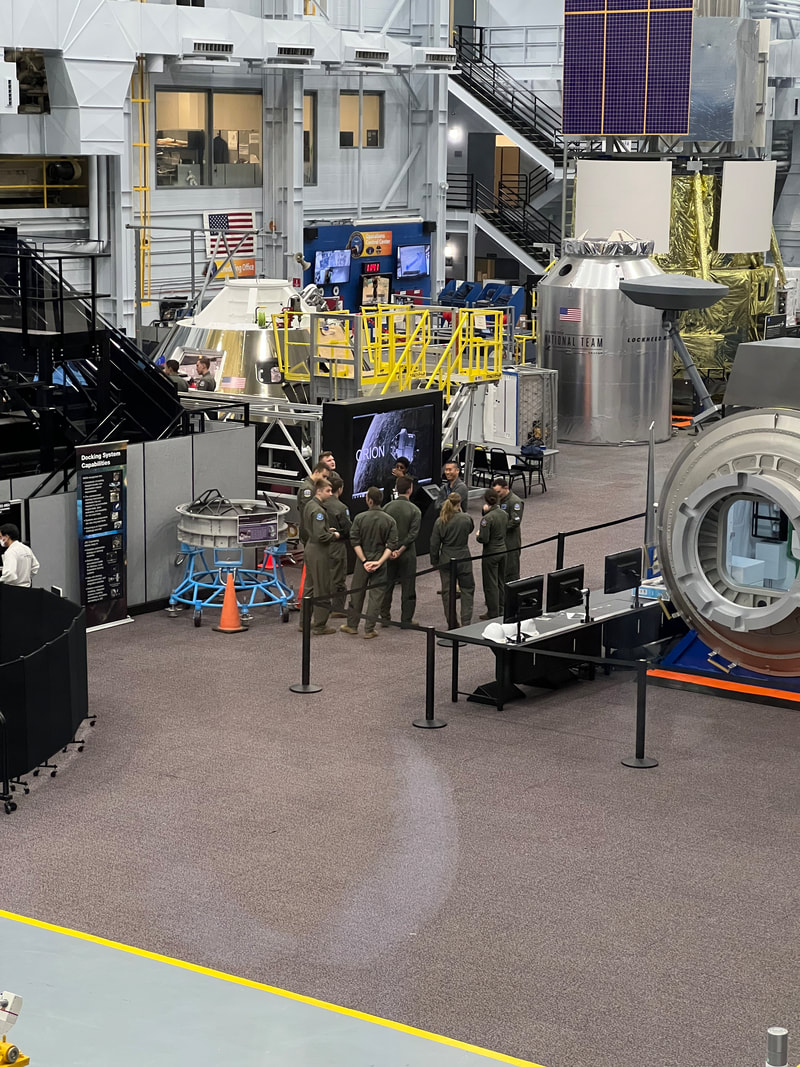
Real astronauts in training!
Picture
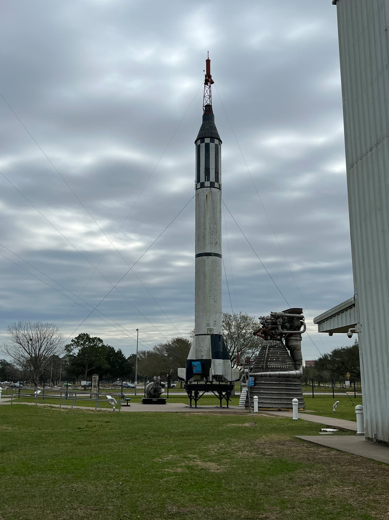
One of the first rockets to go into space.
Picture
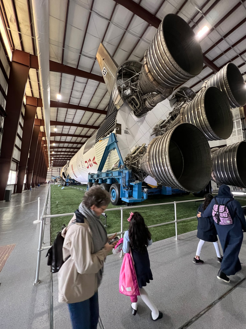
A real Saturn V rocket, used to launch the Apollo missions.
Picture
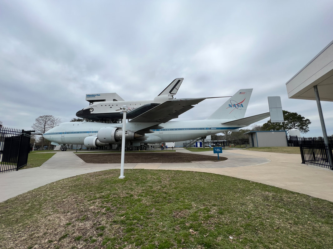
A realistic mock-up of a space shuttle, riding on top of an actual 747 that was used to move the shuttles.
Picture
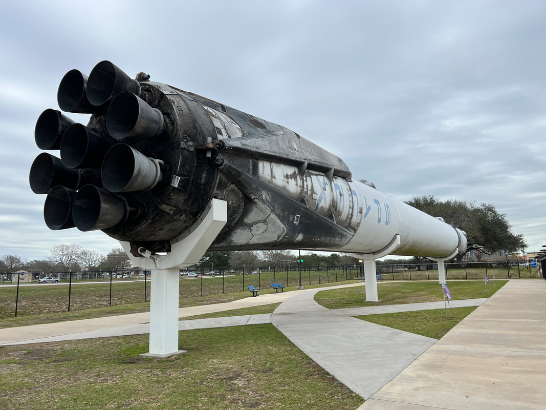
A well-used SpaceX rocket which completed over 50 trips into space.
Picture
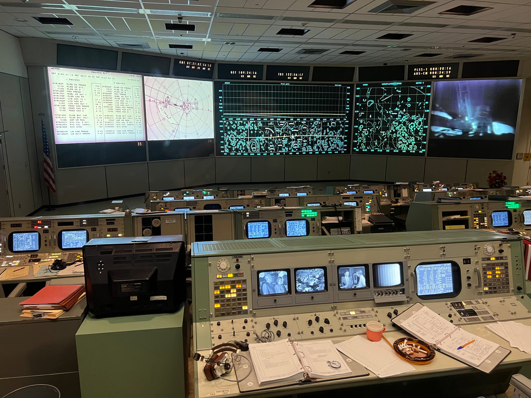
Mission Control, Houston. This is the control room for all of the Apollo missions. If you ever go to the Space Center, put this tour on your list.
Our Mission Control tram tour was the last tour of the day, so that was the end of our Space Center Houston day.  Our tentative plan had been to head to Galveston to go to the beach, but because the weather was chilly and it was getting late, we decided to instead head towards San Antonio.
0 Comments

New Orleans, Baby

1/24/2023

0 Comments

 
We left Baton Rouge for the very straightforward drive to New Orleans.  We’d researched places to stay, and decided to stay at a Harvest Hosts site, the Faubourg Brewery.  From what we could see, almost any place anywhere near the city had questionable security, and there were reports of people’s bikes being stolen off the back of their vehicles, and harassment by local people, and all sorts of stuff we don’t want to do.  Faubourg boasts a completely enclosed property, which has a gate locked to vehicles AND pedestrians from 8PM to 6AM every day.  And, because we’re Harvest Host members, the first night is free, subsequent nights are only $20, and we get a 10% discount in the brewery for food and beer.  So, we booked three nights and pulled up late in the afternoon on Sunday, in time for brews and dinner.

Faubourg Brewery has a huge parking lot, and room for a pretty much limitless number of RVs.  We picked a spot, parked, and, because we were starving, went inside to forage.  The staff was immediately super friendly and started offering us little cups of beer to sample, and when we decided on what we wanted, we got our pints and headed for the kitchen area, where we ordered food.  Tom had a crab cake sandwich, which he said was okay, and I had crawfish poutine, which was out-of-this-world delicious.  I ate past the point where I knew I should stop, to the point where I woke up at 4AM with an upset stomach.  But, it was oh so worth it.  The funny thing was that when I ordered, the cashier said they were out of it.  After my totally crestfallen look, she told me to wait a minute and went in the back to talk to the chef.  She came back and asked if I was okay if the chef made me a substitute dish, and when I pointed out that it was fine because I didn’t know what the real thing was supposed to be anyway, I got my order.  After eating it, I have difficulty believing that whatever it was supposed to be could possibly be any better.
Picture
Picture
The view of the brewery from my kitchen window. It’s a big building!
Picture
Crawdad poutine.
The next day, when I was sure my stomach was recovered, we Lyfted into the French Quarter to meet my college friend Emma at Cafe Du Mond for coffee and beignets.  The coffee and beignets totally lived up to their reputation, although it wouldn’t have really mattered if they didn’t since we had so much fun catching up on what we figured was 40 years.  Emma, like us, has lived and worked all over the place, so after a lot of animated conversation about life, she took us shopping in the public market, where she was looking for a hat for a Mardi Gras party.  She didn’t find a whole hat, but found some hat components, and Tom found a wallet, so after a successful shopping expedition we went back to Jackson Square to say goodbye, with assurances that we would keep in touch, at least through Facebook.
Picture
Emma and me in front of the Andrew Jackson statue in Jackson Park in front of the cathedral in the French Quarter of New Orleans.
Tom and I spent the rest of the afternoon wandering through the French Quarter, taking photos in Jackson Park, Bourbon Street, the historical Jazz Bars, and of the rest of the architecture, which reminded us a lot of parts of Guatemala.  We thought that was weird, until Emma told us that the French and the Spanish traditionally handed New Orleans back and forth, when it made more sense that we could see the Spanish influence.  
Picture
Typical French Quarter building.
Picture
Bourbon Street
Picture
One of the National Historical place jazz buildings. They’re all sort of a wreck, unfortunately.
Picture
The walk along the river
We had traditional New Orleans food in one of the French Quarter restaurants before heading back to the camper with plans to return the next day, today, to go to the World War II museum, take a walking tour, and possibly meet up with some friends who were coincidentally in the city.  However, we woke up this morning to dire weather reports predicting high winds, torrential rains, and possible tornadoes.  We still toyed with the idea of calling for. Lyft into the city, but finally decided that we’d feel really terrible if something happened and we were stuck in the city while the dogs, cat, and camper were over the canal at the brewery, so we decided to stay put for the day, wait for the bad weather to pass, and catch up on a bunch of stuff like blogging for me and a few work projects for Tom.  As it turned out, the weather was pretty wretched and we probably wouldn’t have been very happy wandering around the city, so we were content with our decision. 

In the middle of the afternoon, the Faubourg employee who manages the Harvest Hosts effort came knocking on our door, as well as the doors of the RVs parked near us.  She wanted to make sure we were aware of the weather watches and warnings, and to tell us that we could do whatever we felt we needed to do to stay safe.  We were aware and had in fact been following the weather all day, but apparently a number of our fellow campers had not and had no idea what was going on.  I don’t think any of the RVs decided to leave, which was an option, although I have no idea where anybody would have gone since west and north would be running into the bad weather, south is the Gulf of Mexico so not an option, and east would be maybe, barely, staying ahead.  A few of the RVs decided to just stay where they’ve been parked, but we and a number of others decided to cozy up to the building.  Most of them stayed on the front side, which is nice right now because they are completely shielded from the wind.  However, there is a long zinc roof over a loading dock on that side, which makes the Belizean in us very nervous since we know what zinc roofs do in high winds.  So, we are all by ourselves on the south side of the building (the others are on the west), snuggled up to a cement wall with no zinc roofs in sight.

Picture
We spent the evening in the brewery drinking beer and eating wings with the other campers, all of whom are in good spirits.  We are, as we do, making friends with the employees, and I even gave the dregs of my bottle of Marie Sharp’s Smokin’ Marie’s hot sauce to the chef, who was shocked that I was scarfing down his honey habanero wings without breaking a sweat.  He understood my nonchalance about the wing sauce after tasting the Smokin’ Marie’s, and we had a good laugh when he brought a sample out to one of his cooks, who wanted to know why in the hell the chef was trying to kill him.  We’re hoping the chef will visit us in Belize, where we will drag him around to all of our favorite places to eat, as well as getting him all the ingredients and giving him free rein in my kitchen.

Tomorrow, provided the storms pass without too much destruction, we are heading west.  We want to visit the Houston Space Center and revisit San Antonio and the missions on the way to Big Bend National Park, where we will be looking up the camp hosts we just met here tonight.  Life on the road is not good - it is GREAT!
0 Comments

Baton Rouge, Louisiana

1/24/2023

0 Comments

 
We drove south out of Mississippi in the continuing hard rain.  The rangers at Melrose had advised us against taking the mansion tour so we could get on the road and get to a good stopping place in Louisiana before dark, especially with the bad weather which made for slow going.  We had again turned to iOverlander for a parking spot for the night, and this time the iOverlander advice was spot on with the recommendation for the old ferry landing in Saint Francisville.  The town of Saint Francisville is quite charming, with lots of little shops and old houses which have been beautifully restored.  All of the old buildings and historical points of interest are marked with informational plaques, as is the old ferry landing where we parked.  The ferry landing is at the end of the road and runs into the river, and the wide open gravel parking lot is lined with “Public Parking” signs.  The rain took a break just as we pulled in about an hour before dark, so we put on our walking shoes and took the dogs for a walk through the town.  The night was quiet and we weren’t bothered, although for some reason through the night a lot of cars drove to the end of the road, did a loop through the parking lot, and then headed back down the road.  We had expected cars in and out with people fishing, but not the cars just driving around for no apparent reason.  We probably would have slept better if we had spent a second night there, but for just one night, both of us were awake off and on trying to figure out what was going on outside.  
Picture
The road runs into the Mississippi River where the ferries landed until 2012, and we had the whole parking lot to ourselves for most of the night.
Picture
The town is full of charming old houses, all painstakingly maintained.
Picture
Even the small houses are well kept . After widespread disrepair everywhere in Mississippi, where it looked like nobody cared about making things nice, this town in Louisiana was a welcome change.
In the morning, we took another walk through the town before heading for Baton Rouge, the capital of Louisiana.  After being disappointed in both Alabama and Mississippi, we were ready for more disappointment, but we were pleasantly surprised.  While some parts of Baton Rouge are definitely better off than others, we didn’t feel the hopelessness we felt in Mississippi, and it looked like people actually tried to make whatever they had nice.  And, the capitol itself is not only the tallest capitol building in the country, built in the Art Deco style, but it is also surrounded by well tended grounds, with a lake on one side, a garden where an assassinated governor is buried on another, the original Louisiana State University grounds on the third, and another park with an ammunition magazine museum and an ancient Indian mound on the fourth side.  Even on a chilly Sunday morning, people were around, walking dogs, looking at the gardens, and generally enjoying the grounds.  
Picture
The Louisiana capitol is the tallest in the country.
Picture
A lake is on one side of the capitol complex, seen here from the top of the Indian mound.
Picture
The white plinth in the center of this photo is the grave of the governed who was assassinated in the capitol building.
Picture
We left Baton Rouge in the sunshine, heading for a few days in New Orleans.
0 Comments

Mississippi, Part 2

1/24/2023

0 Comments

 
We stayed at Rocky Springs Campground until Friday morning, when Tom received a text from the guy at the motorcycle shop telling us that the scooter battery was in and charged and could be picked up any time.  We backtracked up to Jackson and picked up the battery.  We then decided that it would be worth the drive west to Vicksburg to see the Vicksburg National Military Park.  Our only problem was that we weren’t finding any listings for anywhere to stay in that area, other than overly expensive RV parks like KOA.  But, I kept digging, and found one listing for a small RV campground right next to the park.    We called and they had availability and said it was only $25 for the night, so we headed for Vicksburg.  

The RV campground is less than a 1/2 mile from the park, so we decided to check in before going to the park.  We quickly figured out why it’s not very popular; it’s old and run down with lots of garbage around, and inconsistently staffed.  When Tom went to check in, the price had gone up to $35, plus taxes and fees that pushed it up to $40, which still isn’t ridiculous, but it was annoying.  But, we had full hookups, so we made good use of the $40 and ran our heater even through it wasn’t freezing, and we did a couple of loads of laundry, and left the next day with full water tanks.  And, after we toured the park, we were set up and making dinner in 15 minutes after leaving the park.

We were really glad we decided to visit Vicksburg.  It was a great comparison to Gettysburg, and it was interesting how they’ve laid out the park.  The park wraps around the city of Vicksburg, and includes battle monuments, one old house, the national cemetery, and the USS Cairo.  The only way to see the whole park is to drive around the loop road, which we did.
Picture
This arch marks the beginning of the driving route through the park.
Picture
Like Gettysburg, the grounds are riddled with monuments and cannons, and with signs explaining the flow of the battles.
Picture
This Illinois memorial monument is the largest monument in the park.
Picture
Unlike Gettysburg, where all of the major monuments were for the Union troops, many of the Confederate states had large and impressive monuments.
Picture
This photo shows not only some of the smaller monuments but the red and blue signs explaining the flow of the battles. It also shows the difference in the terrain between Vicksburg and Gettysburg, which greatly impacted how the battles were fought. Gettysburg battles rolled over relatively flat fields, where the Vicksburg battlefield is an endless series of small hills and ravines which prevented any charges. From what we read, it seems that the battles were fought by dragging cannons from hilltop to hilltop so opposing forces could shoot into the other side’s ravines.
Picture
The National Cemetery makes it very clear how high the death toll was at Vicksburg. The cemetery has more than 17,000 graves of fallen union soldiers. There is a separate cemetery for confederate soldiers that is not in the national park.
Picture
The USS Cairo was recovered from the bottom of the river, where it was torpedoed near the end of the Civil War.
We ended our Vicksburg tour by walking the smaller southern loop with the dogs before heading back to the campground.  Despite being run down, the campground was quiet and peaceful, and we had a quiet night before heading south towards Louisiana in the morning.  Our original plan had been to stop at the Natchez Historical National Park and then go to the National Forest, but it was pouring rain so we did a quick outside tour of the Melrose Farm before heading towards Louisiana.  
0 Comments

Mississippi, Part 1

1/24/2023

0 Comments

 
For us, it doesn’t seem that any day goes as planned.  Jackson was supposed to be only about 45 minutes from Roosevelt State Park, but as we were driving Tom asked me to see if there were any motorcycle shops to try to get a new battery for my scooter.  I found one on SR80, which was the road we’d been traveling ever since we drove into Alabama and continued into Mississippi, and which would take us into the capital.  But, in the relatively small town of Brandon, we ran into stopped traffic, and most of the cars in line in front of us were turning around to take another route.  Following the lead of the locals, we turned around as well and got on I-20.  We only took it a few exits before getting off and getting back on SR80, and it turned out we were just a couple of miles short of the motorcycle shop.  We pulled in, found it was open even though Monday was a holiday, and Tom asked about the battery.  They didn’t have one in stock, but said they could order it, but also suggested another bike shop on our route to Louisiana where we could try.  We got back on SR80 heading towards Jackson, when Tom spotted a Love’s truck oil and lube garage with huge bays.  Our truck was about 1000 miles past due for an oil change, so Tom veered in (as well as you can veer in a cumbersome 8-ton camper) to see if they could do an oil change.  The whole staff was really happy and friendly, and they said they could, but that they didn’t have any filters for our truck.  It’s probably no surprise to anyone who knows Tom, but we are, of course, traveling with a few spare parts for the truck, and the oil filter was one of them. (It was actually one of three, so we still have enough for two more oil changes.)  The guys at the shop had us drive around to the back of the building and get in line to drive into the bay.  They had to finish the truck in front of us, but we used the wait time to get lunch, and we were in and out in just over an hour.  


At this point, we were only about 10 minutes from the Mississippi State Capitol.  Being MLK Day, we didn’t encounter any traffic, and the downtown capitol area was empty.  As we were driving into the city, we noticed that Jackson is more than a little run down.  Within blocks of the capitol, we saw abandoned buildings, many buildings in need of major renovations, and overgrown empty lots filled with garbage.  The streets were horrible, with chunks of pavement coming up, large potholes, and so many seriously uneven spots that getting down the street was like driving an obstacle course.  I made the comment that we seemed to have arrived after the apocalypse, and Tom asked if I’d seen anything in the news about Jackson being hit by the tornados.  I hadn’t, so we can only guess that it’s always like that.  To give the city a little bit of credit, it was much improved for three or four blocks around the capitol which, besides being in need of a good power washing, is quite pretty and substantial.  We were able to park in a church parking lot kitty-corner from the capitol building, so we were able to walk around the grounds, which are much more park-like than Montgomery, and were being maintained by a large crew of workers even on the holiday.  Tom had been warned by one of the guys in the motorcycle shop that downtown Jackson was very rough and a little dangerous, but we didn’t feel at all threatened, and actually didn’t see anyone other than the guys working on the grounds who were all friendly and waved and said hello.  We felt nowhere near as uncomfortable as we felt in Dover, DE, or, for that matter, in Atlanta with all of the homeless people.  I guess we can give Jackson some points for not feeling dangerous, but as we drove out of the city on the other side that post-apocalyptic look returned, the roads continued to be horrible, and we left, glad to have Jackson in the rear view mirror. 
Picture
Picture
​Our original plan on Monday morning had been to drive to Jackson, see the capitol, and then head south to the Homochitto National Forest and find a place to camp.  However, we didn’t get out of Jackson until almost 3PM, so we started looking for places closer to Jackson.  We’re really glad we did, because we quickly realized that the Natchez Trace Parkway, which is a National Park road like Skyline Drive or the Blue Ridge Parkway, runs right through Jackson.  And, about 30 miles south of Jackson, there’s a National Park Campground called Rocky Springs Campground.  And…it’s free.  It only has 22 campsites, and it doesn’t have any hookups or even potable water, but all of the sites are paved, relatively level, and nicely spaced out.  You can’t make reservations, so you just have to show up and hope you can find a space, but we decided to try since it is less than an hour from Jackson.  We took a minor detour off the Natchez Trace Parkway to stop at a Kroger and stock up on groceries, and headed for Rocky Springs.


On a rainy Monday evening in January, we didn’t have any trouble finding a very nice spot.  Only five or six other campers were here, which were a few vans, a couple of tents, and a couple of cars which may have been people parked for the day, or people might have slept overnight in them.  We took the dogs for a quick walk around the area, and settled in for the night.  In the morning, we took the dogs for a longer walk around the area, which is quite interesting because Rocky Springs is an abandoned town, so besides getting to walk on the genuine Natchez Trace, we could see the remains of the village in the forest.  Tom had called the more southern motorcycle shop and found that they didn’t have the battery we need, so he decided to call the shop we’d visited before visiting Jackson to see if they could order it.  They could, and said it should be ready to be picked up by Friday, so we decided to spend most of the week at Rocky Springs Campground, hiking the Natchez Trace, doing some of the endless camper maintenance jobs, and relaxing.
Picture
This church is the only building remaining from the Rocky Springs settlement. Services are still held in it once a month.
Picture
Stopped for a few days we took the time to take the scooter off its back rack - and actually use it - as well as to set up our new screen room.
The park surrounding the Natchez Trace Parkway is very narrow, so we didn’t have a lot of hiking opportunities.  On Tuesday, we hiked around the immediate Rocky Springs area, and visited the still standing church and its cemetery.  We were again struck by the number of graves of children in the cemetery, and pondered how the anti-vaxxers can continue to rant against vaccines when it’s so obvious that they’ve made such a huge difference in child mortality rates.  We looked at cisterns and safes, which are about all that’s left of the village.  The signs give lots of reasons why the village failed and was abandoned, but the most obvious was that the settlers were trying to farm in soil so prone to erosion that the entire area is a series of washed out ravines where even the trees can’t hold the ground together. ​
Picture
The majority of graves in the cemetery are of children.
Picture
Erosion is still a problem.
On Wednesday, we took another hike south on the Natchez Trace to find the Owens Creek Waterfall.  The 2.5 mile hike turned into more like a 4 mile endurance test by the time we detoured around the washed out ravines, but we saw lots of interesting birds and encountered another old cemetery in the middle of the woods.  This one didn’t have as many dead children, but the latest death date we could find was 1902, so the cemetery has apparently been abandoned for quite a while.  Shortly after the cemetery we abandoned the trail and hiked the rest of the way to the waterfall on the parkway, which probably saved us and the dogs a lot of ticks. 

We were glad we did it, since the waterfall was a few drops of water going over an eight foot ledge, and while it was pretty, it wouldn’t have been worth fighting through the underbrush.  The walk back to the campground on the road was only about 2 miles, which we did in about 45 minutes rather than two hours. 
Picture
Owens Creek Falls…not much of a waterfall compared to what we’re used to in Belize.
Picture
We hiked on the real Natchez Trace, portions of which are still obvious as you hike through the woods.
​Back at the campground, we talked to other campers and watched how this free national park campground is used.  We’ve found a lot of other free places to park on our trip, but this is our first free official campground.  It’s different, and is making us a little bit sad.  At the pay campgrounds, we’ve found a lot of vacationers in a variety of vehicles, from cars with tents to vans to Class Cs to the big fancy expensive Class As.  Here, we’re not finding a lot of vacationers.  There’s one other guy traveling with his old dog in a self-built utility trailer camper, and a family camping in a couple of tents, but they’re the only other vacation-type travelers.  We met a couple pulling a travel trailer who are making their way north to welcome their new great-grandchild, who stay at places like this for a few days when it’s on their route, so they’re sort of vacationers.  A few other vans or travel trailers have pulled in for a night or two and then moved on, which is probably about what we would do if we weren’t waiting for the moto part.  But then, there’s one old guy who’s living out of his car and sleeping in his tent and moving from campground to campground as his 14-day limits expire.  He’s one of a number of gray-haired men we’ve seen and talked to, traveling alone, and living out of their vehicles which are mostly vehicles like 20-year old Toyota Corollas or Honda Civics.  For the three nights we’ve been here, we’ve noticed three or four cars a night, always different, being driven by older men, traveling alone, who pull in, sit outside for a few hours, then sleep in their cars, before driving away early the next morning.  This is the type of thing you don’t see unless you take the time to stop and look and think, and we’re a little ashamed of ourselves that, like most other Americans, we’ve managed to not SEE it for so long, even though it’s right in front of our faces.  I don’t know that there’s anything any individual can do about it, but at the very least seeing it might affect how people vote, since it seems to be an unacknowledged problem in the US.  I don’t know how many of our guests at our jungle lodge in Belize commented on how uncomfortable they were with the poverty in Belize, and it’s probably a good thing we are no longer in that business because I think I’d be recommending that those guests take a drive through Alabama and Mississippi and stay at some of the free campgrounds to see that the same poverty is in their own backyards.  I’m also going to stop making jokes about being homeless and living in our vehicle, because when you see people who are really doing it, it isn’t very funny.
0 Comments
<<Previous

    Meet the Moonracers

    Tom and Marge are taking Moonracer Farm On The Road Again.  Follow our journey to build an expedition vehicle and travel!


    Overnight Stops

    Archives

    January 2024
    September 2023
    August 2023
    July 2023
    June 2023
    May 2023
    April 2023
    March 2023
    February 2023
    January 2023
    December 2022
    November 2022
    October 2022
    September 2022
    August 2022
    July 2022
    June 2022
    May 2022
    April 2022
    March 2022
    February 2022
    January 2022
    December 2021
    November 2021
    October 2021
    September 2021
    August 2021
    July 2021
    June 2021
    May 2021
    November 2019

    Categories

    All

Web Hosting by Netfirms