___Moonracer Farm OTRA
  • MRF OTRA Blog
  • Moonracer Farm OTRA
  • Capitols Visited
  • Contact Us

Denali National Park

9/13/2023

1 Comment

 
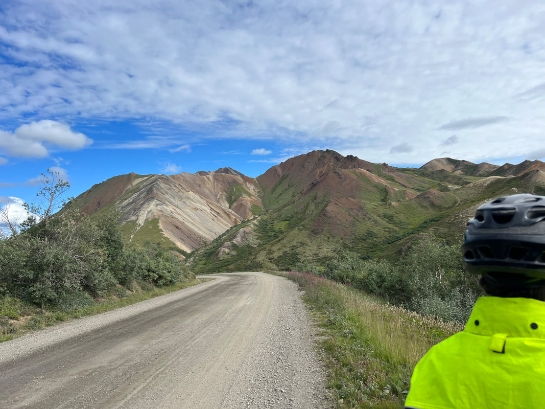
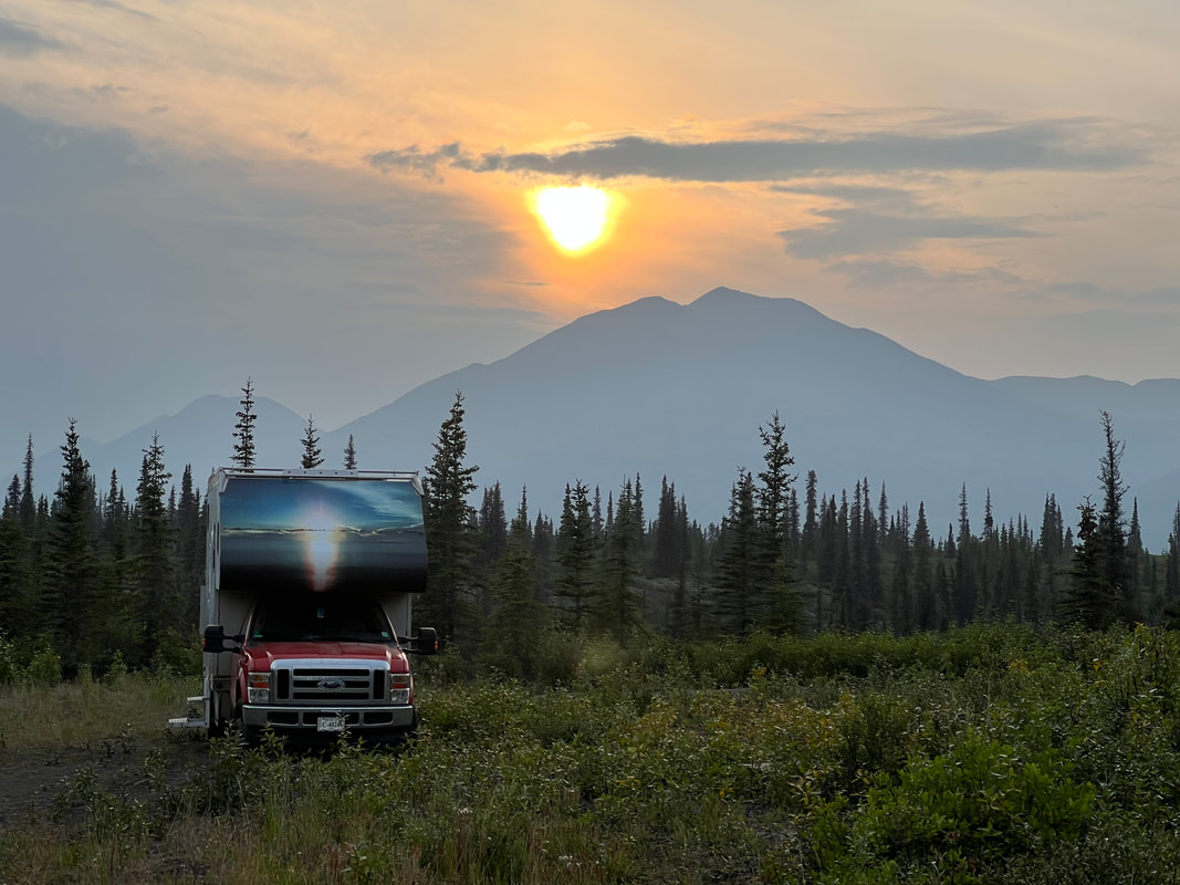
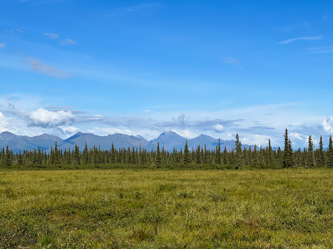
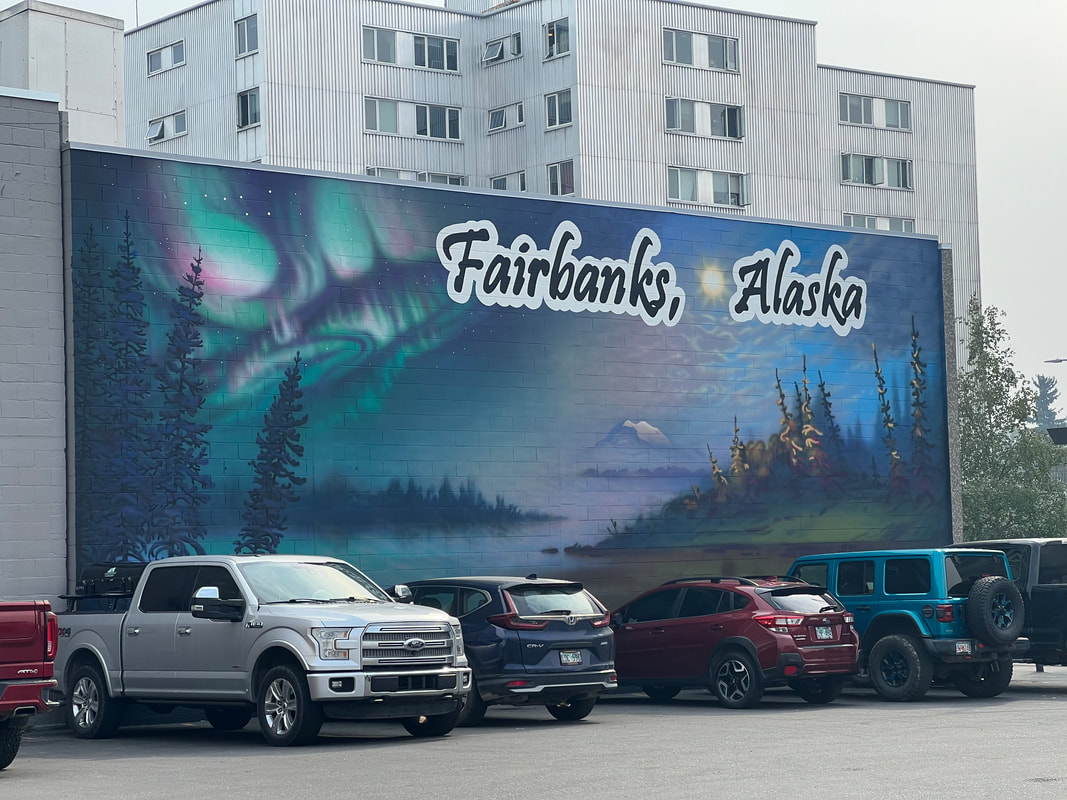
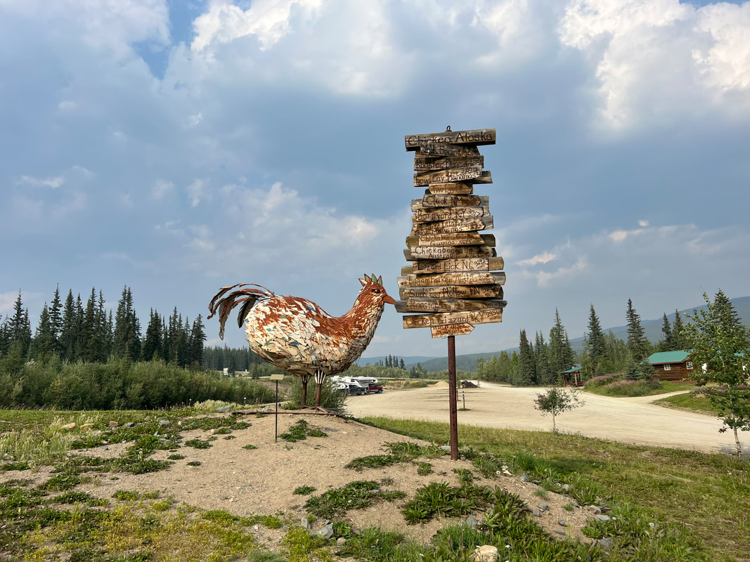
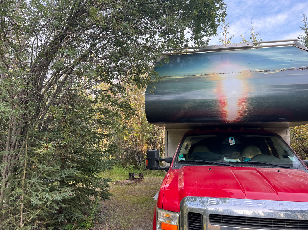
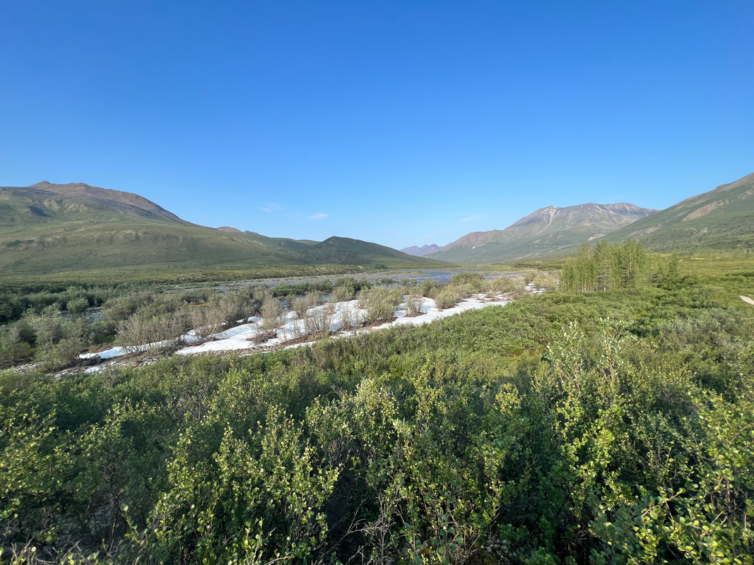
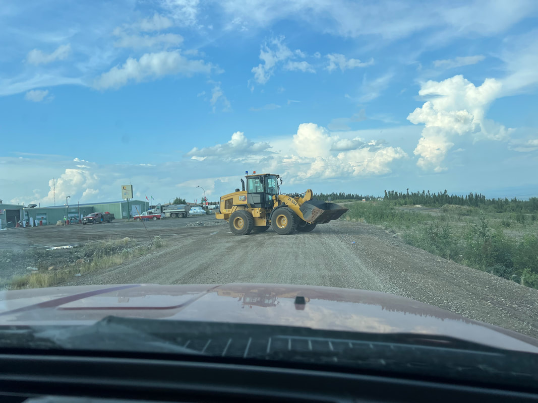
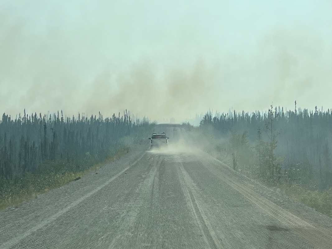
We drove off the Denali Highway and went to a super nice grocery store in Healy, which was completely unexpected.  We didn’t expect a tourist town in Alaska to have a grocery store with fresh wild caught salmon, and good fairly reasonably priced fresh produce, but they did.  After stocking up, we drove into Denali National Park and checked into Riley Creek Campground to get the paperwork to head to Teklanika. We had made reservations for three nights at the Teklanika Campground, which we were only able to do because our friend Wayne Hall in Anchorage not only recommended it, but also lurked on line until he found a window with reservations and immediately contacted us to make them.  Teklanika is special, and we didn’t even realize how special until we got there.  Like the other national parks, Denali is trying to continue to keep the park accessible without having it overrun with tourists, and without having the traffic impact the wildlife and the environment.  Part of the effort to do this is to close the road to the public at Savage River, which is only about 15 miles into the park.  After Savage River, the only vehicles allowed on the park road are the park buses…and cars and campers going to Teklanika for a minimum three night stay.  Those going to Teklanika get a lecture on the rules for driving the road, which are basically to take your time, but go directly to the campground, where you must stay until the day you check out, when you must drive directly back to Savage River.  

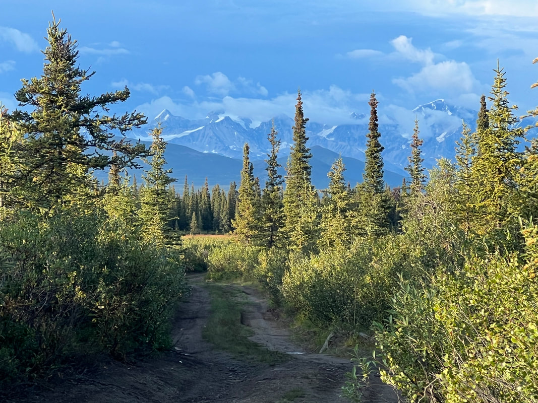
The park has devised a system where they have a combination of transit buses to move people from point to point in the park after Savage River, and tour buses, which take people to the end of the road with frequent stops to see wildlife.  They suggest that people who camp at Teklanika get transit bus permits to get around in the park after the campground, but we elected not to do that, although the park personnel asked us repeatedly if we were sure.  The problem for us was that the transit bus tickets were over $30/person/day.  Normally, the park road runs all the way out to the Eielson visitor center and Wonder Lake, but because of a landslide that closed the road, the buses only go about 15 miles beyond Teklanika.  If we had had the option to go another 60 miles beyond Teklanika, we would have undoubtedly opted to get transit tickets for at least one of the days we were there, but for 15 miles, we decided that we would just ride our e-bikes as far as we could go.  We talked to lots of other campers and found that we were definitely in the minority.​

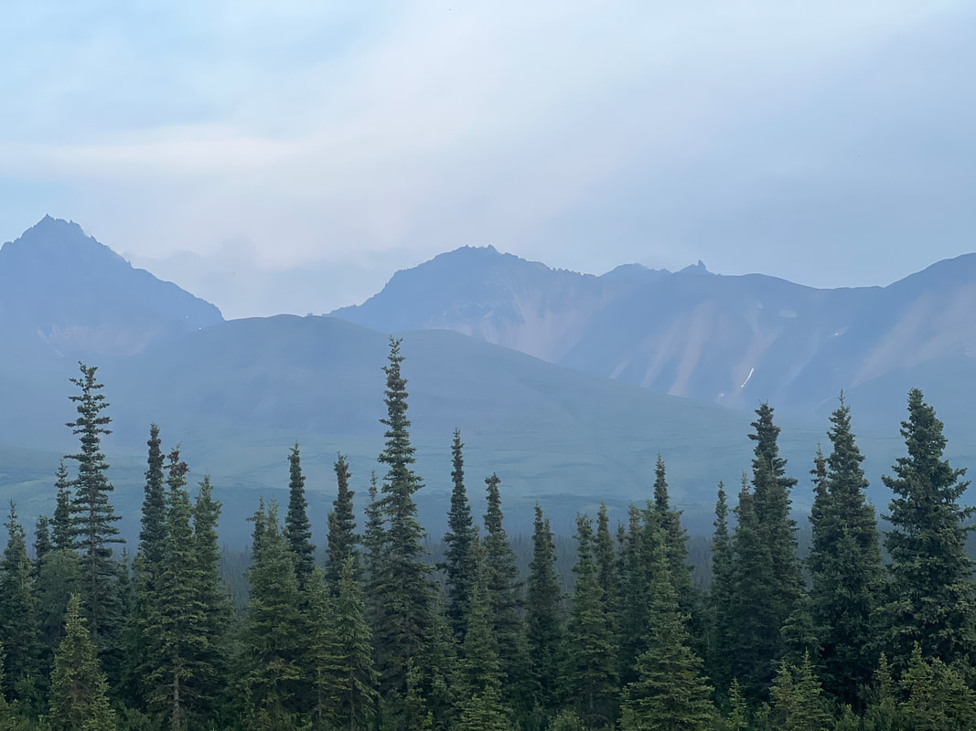
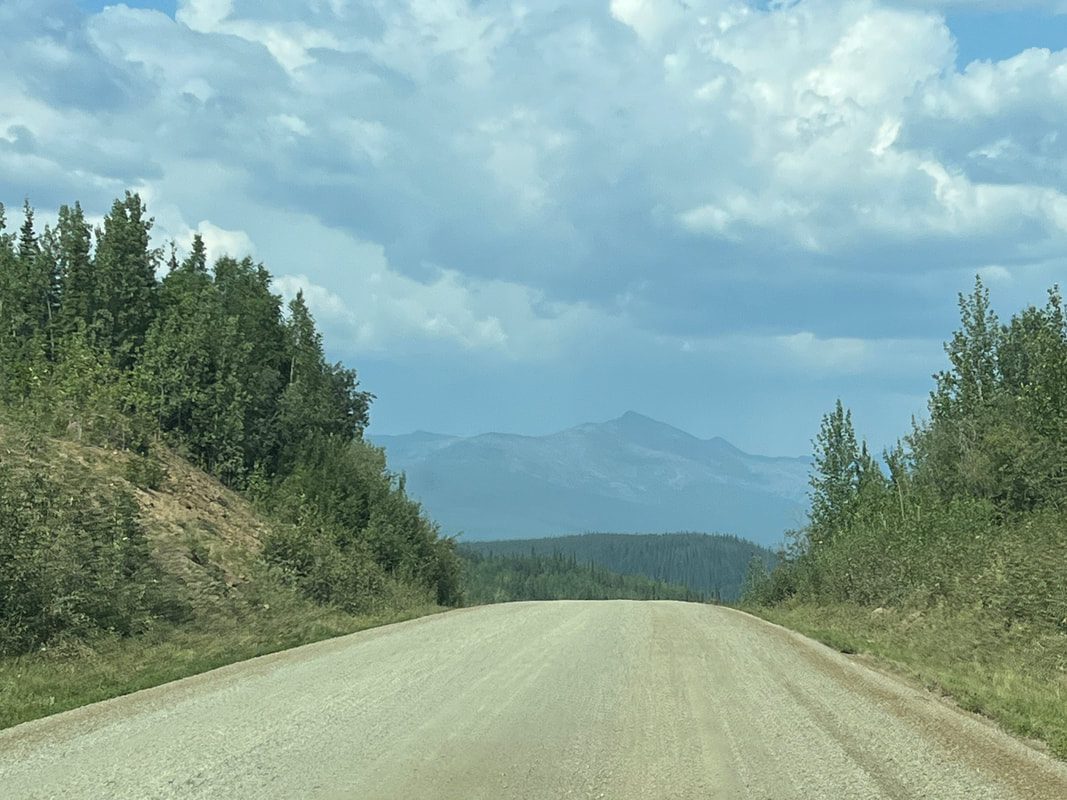
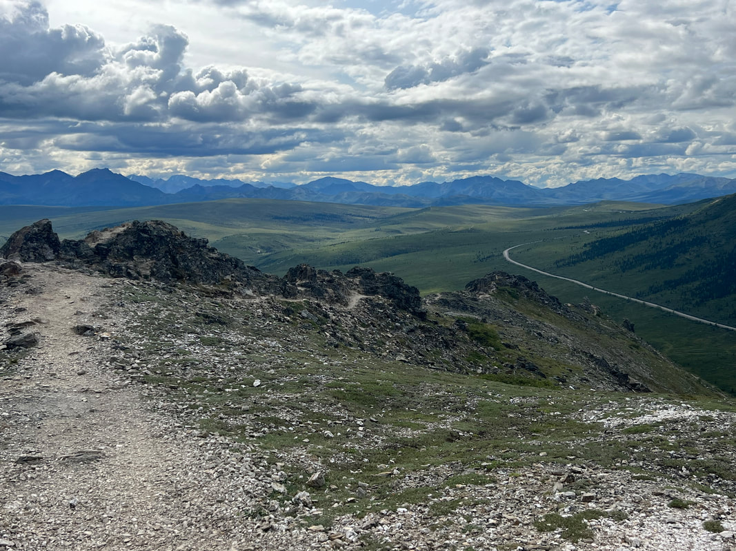
After getting our first lecture at the Riley Creek Campground and being quizzed to make sure we understood the rules, we headed for Savage River and did a great hike.  We then went through the last check point and got another extensive briefing by a ranger, and drove the last 15 miles to the campground where we had to stay parked until Monday morning. 
Picture
Picture
Picture
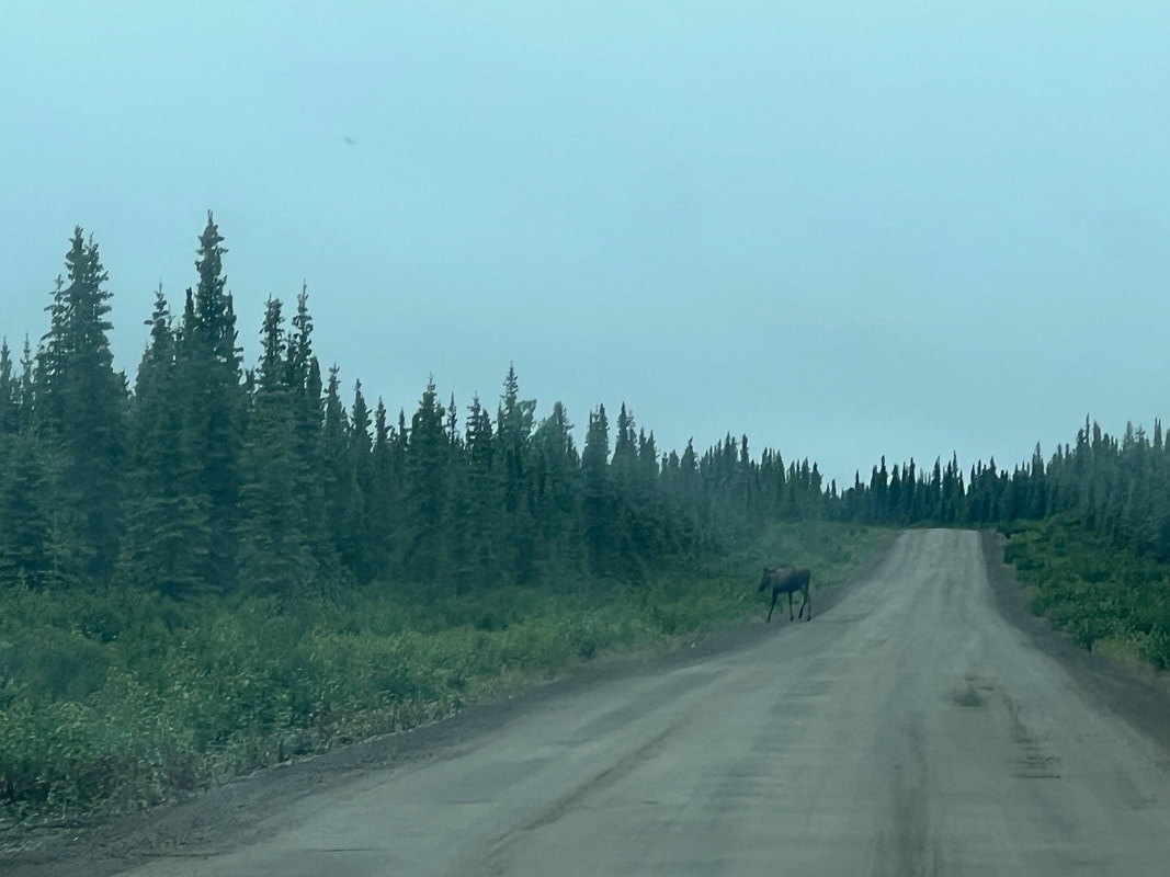
​We saw our first grizzly with Saturday morning breakfast in the campground. Someone walking his big dog went by the campsite and we heard him say there was a grizzly on the trail. We stayed put, then heard our across the road tent camping neighbors yelling “go away bear,” so we went out to make the group bigger and make more noise. The bear was standing at the edge of the clearing, not more than 20 feet away, trying to decide if it should join them for breakfast. When all the campers in the area showed up and started yelling, he turned around and wandered away, stopping for a roll in the grass.  Part of the ranger’s briefing had been how to react at bear encounters, and we were glad that not only had we listened, but all of the other campers in our area had listened as well.
Picture
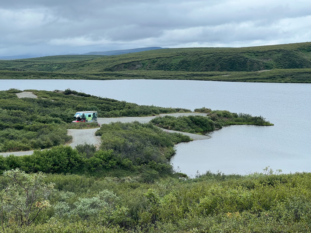
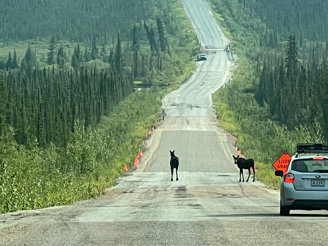
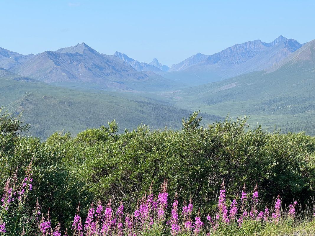
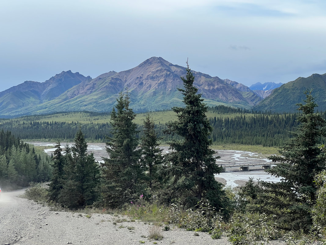
​The rest of Saturday was not too exciting. We took a nice walk west to the bridge over the river, which was about 2 1/2 miles, and then turned around and came back and cut down to the river to walk along the wash back to the campground.  After lunch, we got on our e-bikes to head towards the end of the road. We peddled uphill for about 10 miles and right before the crest of the hill in Sable Pass, Tom’s bike started making a funny noise and his chain was off. But it wasn’t just the chain. The whole sprocket was broken. Fortunately the first 10 miles had been uphill and we hadn’t started down the other side yet so we were able to coast back with only some pushing and skating by Tom on the broken bike.  Somehow, we made it back almost as quickly as we made it out.
Picture
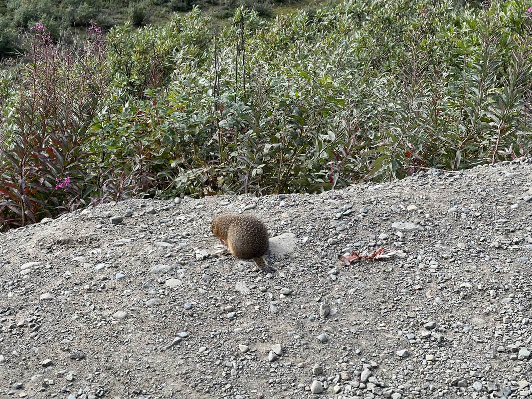
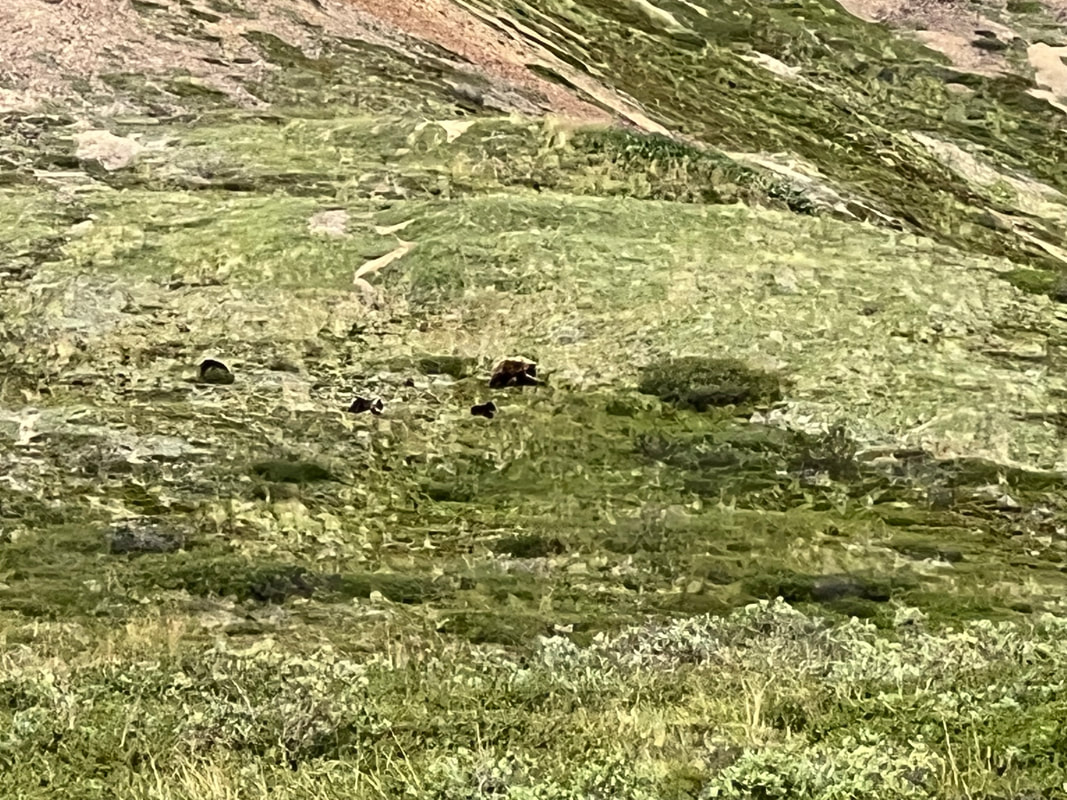
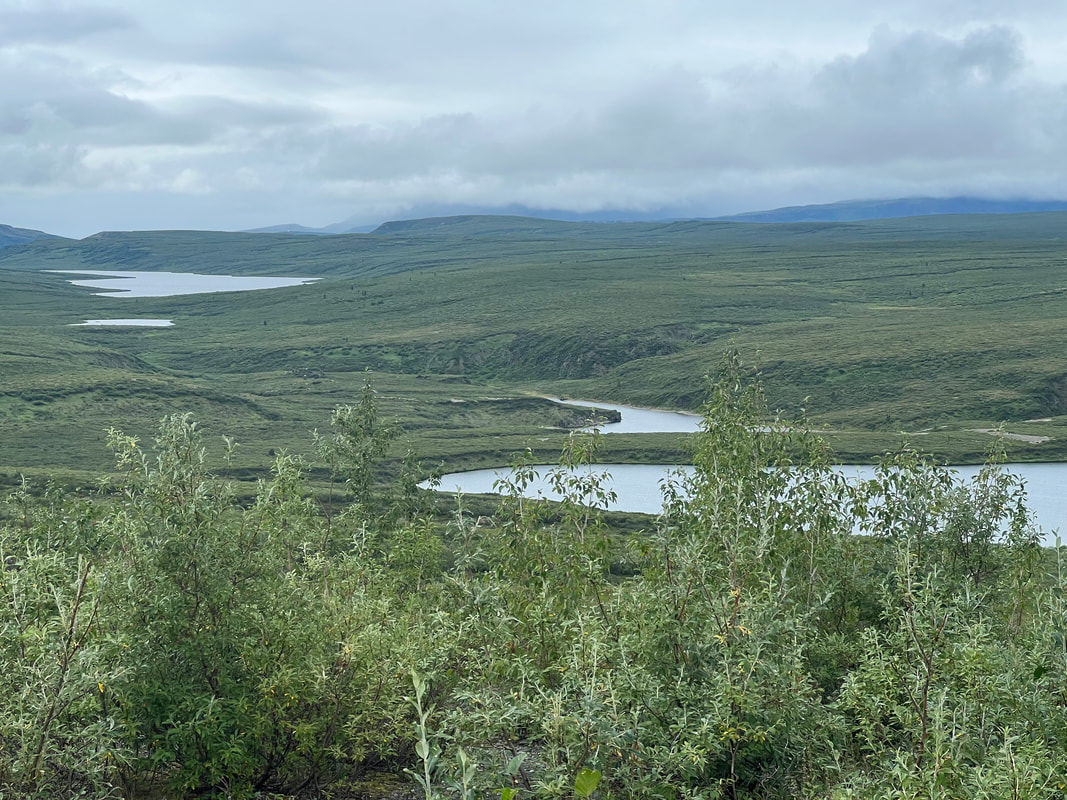
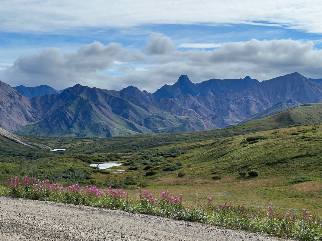
​Sunday was much more fun. Some fellow campers offered Tom the loan of an E-bike so we could do the ride on Sunday that we had intended to do on Saturday. It was a great ride and we made it almost to the end, when we were turned around by a ranger because there was a bear in the road which we only saw from a distance. We rode back through the pass, and were about halfway down the first long hill when we saw a ranger truck parked by the side of the road. We stopped and realized she was looking at a mother grizzly with 3 cubs. We watched them amble along the mountainside for a while, until they went over the crest of a hill and we couldn’t see them.  We also saw a bunch of marmots, and were somewhat shocked to find out that they were carnivorous, since one was eating a dead bird, and another was chewing on another dead marmot’s skin.  Most importantly, we made it back to the campground with no broken bikes or other disasters.  When we got back to the campground we talked to fellow campers, and we realized that one of the magical things about Denali is that no matter what your interests or abilities, you can have an adventure.  We had an adventure because we were turned back less than a mile from our goal because we couldn’t get any closer to a bear on our bikes.  The people on the bus by the bear were having an adventure because they were face to face with the bear.  Some other campers were hiking over a bridge, and realized a mama bear and a couple of cubs were right under the bridge.  Another group we talked to had been out in the back country climbing a mountain, when they realized a bear was immediately below them in a ravine.  And that’s just the bear adventures!
Picture
Picture
Picture
1 Comment

Denali Highway, Cantwell to Paxson and back

9/13/2023

0 Comments

 
When we finally got all of our stuff done in smoky Fairbanks, we hit the road.  We ran through even heavier smoke on the way to Denali, but most of the smoke had cleared by the time we got to the park entrance.  Because we couldn’t get a campground reservation in the park until Friday, our plan was to drive the Denali Highway in both directions and boondock there for the three nights before we could get into Denali NP, but since we were driving right by Denali we decided to check out the visitor center while we had time.  We asked rangers a couple of questions we had about our upcoming camping reservation, and then hiked about 2.5 miles to the sled dog kennels, where our timing was perfect to see the sled dog demo and meet some of the dogs.  We hiked back to the visitor center and took our dogs for a short walk around the area, then stopped at the camp office for one more question, then drove to Cantwell to pick up the Denali Hwy.  The first “free” campsite listed on iOverlander turned out to have a $30 fee attached, so we continued east to the next pullout at MP125, which had multiple fire rings and plenty of space to get off the road.  One truck camper was already there, but we were able to park down the hill so we don’t *think* we were in his space…and we had our own fire ring which we did’t use. 
Picture
Picture
Picture
​We spent the whole next day driving through rain and fog on the Denali Highway. We saw two moose, and limited scenery. It finally stopped raining as we neared the end, so we stopped at the lake at Mile 7 and had a gorgeous campsite all to ourselves. We took a walk around the lake, and went inside for dinner.  After dinner, we took the dogs out for last time and found that the clouds had cleared and we discovered that we were surrounded by snow covered mountains and glaciers. It was a wonderful surprise!
Picture
Picture
Picture
Picture
In the morning, after taking yet more photos of the mountains and glaciers surrounding 7 Mile Lake, we drove the last seven miles of the Denali Highway to Paxson, which appears to be a ghost town.  We turned around and headed back east, marveling at the different amazing views around every curve in the road.  We knew we were missing pretty scenery the day before, but the beauty was an order of magnitude higher than what we had expected.  After a week in Alaska, we’d been a little unimpressed after the beauty of Canada, mostly due to bad roads and the fact that we couldn’t see much thanks to either smoke or clouds and fog.  When the rain and fog cleared and took the smoke with it, and we were driving on the generally well maintained Denali Highway, we finally realized that Alaska actually does live up to the hype.  We stopped at lots of pull offs for photos, and we stopped for the night at a pull off very near the Brushkana Campground because we saw a hiking trail on the map.  The trail was beautiful, winding through meadows and pine forests to the creek.  We didn’t see any wildlife, but we saw plenty of animal tracks and a beautiful view no matter which way we looked.  ​
Picture
Picture
Picture
Picture
​The next morning, we only had about 30 miles back out to Rt. 2, where we would head into Denali to camp at the Teklanika Campground for three nights.
Picture
Picture
Picture
0 Comments

Fairbanks, AK

9/13/2023

0 Comments

 
We took a walk around the BLM campground, then got on the Taylor/Top of the World Highway and headed towards Fairbanks.  We found that we prefer Canada’s well maintained dirt roads to the Alaska frost heaved paved roads, and that we make much better time on the dirt.  Nonetheless, we got out to the Alaska Highway, stopped for fuel and to collect email and messages in Tok, and then headed for Fairbanks with a lunch stop and a short hike at Lisa Lake.  When we got to Fairbanks, we immediately went to Giant Tire where we got a good deal on VERY lightly used Firestone tires, and scheduled to have them put on the truck the next morning.  We stayed in the grass overflow parking at the Carlson Center, and took advantage of the walking trail that runs along the river. ​
Picture
Picture
​The next day, Saturday, didn’t go exactly as planned.  We got to Giant Tire and they were putting on the tires when I got a horrible pain in my back and hip, to the point where I almost passed out and ended up sitting in the middle of the parking lot with my head between my knees trying not to vomit.  Since our plan for after Fairbanks was to head into Denali National Park for three nights, which is very remote and doesn’t have any communications, we decided to take me to the Fairbanks hospital ER to get checked out.  They did an EKG and blood and urine tests to rule out heart problems or kidney stones, and then decided that I had just had the mother of all muscle cramps due to dehydration, and gave me a bag of fluids and sent me on my way when I was feeling better, with the assurance from the doctor that he saw no reason why I should die if I went remote for a few days.
Picture
Picture
Fairbanks is full of all sorts of art.
Because we’d spent the whole afternoon in the ER, we didn’t do any of the other things we had planned to do, and the next day was Sunday and nothing was open, so we spent another two nights at the Carlson Center.  On Sunday we hiked all over Fairbanks, which is a pretty little city.  On Monday, Jiffy Lube and a hairdresser were opened, so we had the truck’s oil changed and got haircuts. We had good cell reception, so we used the downtime to get caught up on some computer stuff.  While Fairbanks became a little more complicated than we’d planned, we were happy to get great deals on tires and dog food. ​
Picture
By the time we left Fairbanks, everything was smoky.
0 Comments

Dawson City to Fairbanks via Top of the World Highway

9/13/2023

1 Comment

 
We left the campground around 9:30, but didn’t get out of Dawson City until almost 11 because of a clog in our kitchen sink drain and then we were looking for a place to get a leaky valve stem fixed, and Tom ended up doing it himself.  We took the ferry across the Yukon River to the Top of the World Highway, and thoroughly enjoyed the views, and the very nice dirt road.  We had made sure to use all of our produce and potentially objectionable meat before entering Alaska, but the officer at the border only asked us if we had firearms or firewood, and when we said no to both, he said “safe travels” and waved us through and into Alaska.  We stopped at the first view which had way too many people, so we went a mile or so down the road to another pull off for lunch, and had a nice short hike up the hill to get an even better view than we’d had at the first pull off.  We were a little distressed that our first view in Alaska was of yet another wildfire. ​
Picture
The views from the Top of the World Highway made it very clear how the highway got its name.
Picture
By going into Alaska through this northernmost entry, we have now crossed the border at the southernmost entry and the northernmost entry.
Picture
Picture
This fire was just starting as we crossed into Alaska. Unfortunately, it got much worse and we were socked in by smoke while we were in Fairbanks.
We stopped at the Mosqito Fork Dredge trailhead and hiked the .75 miles to the view of the abandoned dredge, and then back to the truck.  We then stopped in Chicken, where we saw the Chicken Chicken Statue, and more abandoned gold mining equipment at the Pedro Dredge National Historic Site.  Just a few miles down the road we found a family whose trailer springs had broken, and they were trying to fit all of their vacation gear into a small car while waiting for the flatbed to come get their trailer.  We couldn’t do much to help, and the father was obsessed with cramming four people and all their stuff into a Honda CRV, which was going to be impossible, but he needed to focus on something other than the difficulty of getting the trailer to somewhere where it could be fixed.  The mother ended up giving us some chicken and frozen vegetables because she was fretting about spoiled food, which I could totally understand, so I took the food, thanked her profusely, and we got out of the way.  ​
Picture
This part of Alaska was all gold mines. This is the ruin of the Mosquito Fork Dredge.
Picture
Chicken, Alaska, was a gold mining town, home of the San Pedro Dredge. It’s now better known for this chicken statue.
Picture
This is the San Pedro Dredge, which is far bigger than it looks in this photo.
Picture
Prior to the modern day roads, machines like this were needed to reach the dredge sites.
We decided to stop at the Westfork BLM campground since we weren’t sure what the boondocking rules were in Alaska, although when we got there and read the sign we realized we could have pulled off just about anywhere that wasn’t marked for no overnight parking.  But, for the $6 the campsite cost, we got to read the official rules, and see two moose crossing the road shortly before the campground. With sunset at   10:23pm and sunrise at 4:44am due to the hour we gained when we entered Alaska, we slept almost normally.  We hadn’t realized Alaska is on AKDT, which is one hour behind the Pacific Time Zone, but we were glad.
Picture
The campground is just across the bridge beyond the moose. We were glad we hadn’t pulled over earlier or we would have missed seeing the moose.
Picture
1 Comment

The Dempster Highway to the Arctic Ocean

9/12/2023

0 Comments

 
We finished the laundry at midnight when it was still quite light since the sun didn’t set until 11:40.  We filled our water tanks and emptied our gray tank and were out of the campground around 10am.  We drove a couple of miles into Dawson City, where we walked around and looked at stuff for a few hours.  We ate lunch in the camper in the visitor center parking lot and were on the road about 2pm and onto the Dempster Highway.  We decided to stop at the Tombstone Mountain Territorial Campground a little before 4pm even though it’s only about 45 miles north on the Dempster Highway, which was a good thing since by the time we walked over to the visitor center and back less than an hour later, almost every site was full. 
Picture
Picture
Picture
We got up early, ate, and took two hikes before we left the campground area.  The first was a trail from the campground along the river, where we walked to a place on the river where there was still a snowfield in the end of July.  Then we drove a couple of kilometers north and hiked up a mountain to amazing views of the mountains, and the valley which gave us a good view of Tombstone Mountain, for which the park was named.  We then drove north, in awe of the varied terrain, which changed every 30 or 40 miles but which was always beautiful and awe inspiring.  ​
Picture
Picture
Picture
​About 30 miles from Eagle Plains, we saw a gigantic forest fire.  It wasn’t right on the road, but it was close enough to see some flames and lots of billowing black and gray smoke.  We were glad to have it in our rear view mirror.  However, when we pulled up in Eagle Plains, where we planned to fuel up and stay for the night, a big front end loader was blocking both the road north, and the driveway into the tourist center, and we could see a sign near the other driveway saying “Road Closed South of Eagle.”  A couple of campers pulled up right behind us, and none of us wanted to try to squeeze around the front end loader, so Tom and some of the other travelers went into the gas station to see what was happening.  Turns out we were the last few vehicles allowed past the fire, and they weren’t allowing anyone to go south, from the direction we’d come.  After about a half hour, someone came out to move the front end loader to let us into the parking lot, and then moved it back to block the road to south going vehicles.  We filled up, then went to the hotel/RV park office (and I use the term RV park very loosely), and found that the upside to the inconvenience is that because the fire department had them close the campground for fear trees in it might catch fire, and because nobody could go south and had to stop for the night, they’d made dry camping in their parking lot free no matter which direction you were heading.  Since the fire was so far away, we figured the chances of anything catching fire in the area were pretty slim, so we parked in a line of campers in front of the hotel, glad we were going north instead of south in the morning.  We slept okay, although with sunset not until midnight, and sunrise at 4:26, it never really got dark and we still weren’t used to sleeping in the daylight.
Picture
Picture
Picture
Picture
​The road south opened around 9am, so we left the campground heading north ahead of anyone who had been held up at the other side of the fire.  We reached the Arctic Circle before noon, and then headed for the Northwest Territories/Yukon line, where the road got better and we lost an hour due to the time change.  We stopped for lunch at a random pull off and had a nice hike back to a quarry and a lake.  We reached the first of two ferries before Fort McPherson, stopped for fuel in Fort McPherson, and then crossed rivers again at the second ferry, which was about an hour from the Vadzaih Van Tschik campground.  We had another day of constantly changing scenery, and when we talked about it realized we had both been thinking the same thing - this area felt like home because it reminded us so much of Belize, which is really odd since we were in the Arctic Circle, not the tropics.  It helped that it was very warm, with days in the 80s and nights in the low 70s, which the locals said was very strange.  But it wasn’t just the temperatures, it was the road and the vegetation and terrain along the road, and how it felt talking to the locals.
Picture
Picture
Picture
Picture
​With the time change, sunset was 1:16am, and sunrise was 4:45am.  I discovered a bug with the Apple Watch sunrise/sunset complication; if sunset is after midnight, the sunset time never displays, and it always displays the sunrise time.  However, you can get the sunset time by tapping the complication for the full watch screen display.  I eventually reported the bug to Apple, but I’ll have to find someone with an Apple Watch who uses that complication who goes to where sunset is after midnight next summer to see if they fixed it.
Picture
We drove from the campground to Inuvik in about an hour. Inuvik is the end of the Dempster Highway, and used to be the end of the road until about six years ago when the government put the 100 miles of road between Inuvik and Tuktoyaktuk.  Inuvik is a pretty big town with just about everything you could want, and after a few days of no cell reception, it had excellent cell reception with good internet.  We made a quick stop at the visitor center and then started up to road to Tuktoyaktuk. It took 3.5 hours to cover 95 miles with the southern part being pretty good, but the last 60 miles were washboard. But, the scenery was beautiful again, and with little to no traffic it was pleasant. We camped right on the ocean, where the town is deservedly making good money charging tourists $60CA a night to park. We tried to find a restaurant with local food, but none of the restaurants were open, presumably because everyone was at the Saturday night community baseball game, so we ate in the camper. We stuck our hands in the Arctic Ocean, and decided to hold off on a swim because it was cold.  Even though air temps were in the high 70s, the water felt like it was around 45. It was never dark, with sunset at 1:46 am and sunrise at 4:11am, and sleeping was difficult because the locals were running their quads along the waterfront all night looking out to sea for whales to hunt.  I wasn’t sure if I was more bothered by the noise or by the light or by the thought of them all jumping in a boat and going out to kill a whale, and I spent too much time convincing myself that the people have a right to their heritage, even if it involves killing intelligent mammals. ​
Picture
Picture
Picture
Picture
​In the morning, we waded into the Arctic Ocean up to our knees for a quick selfie before leaving Tuktoyaktuk around noon.  The drive back to Inuvik was much faster than the drive north, and we pulled into town a little before 3.  We got fuel, then looked for a restaurant with local food, but being Sunday afternoon, everything was closed.  We parked at the visitor center and took a walk around town before heading south on the Dempster.  We were a little worried about running into fire as we headed south since we went through a few patches of fairly dense smoke, but at the Nitainlaii Territorial Park campground, just before the second Fort McPherson ferry, it was pretty clear.  The ferry didn’t run until 9am, so the plan was to take a walk around the area in the morning, then head south and try to make it to the Engineer Creek Campground by the next afternoon.
Picture
Picture
Picture
​We took a walk to the ferry in the morning, then headed south. The walk was interesting, because one of the guys who works with the ferry system stopped and told us how it all works.  He had crazy stories about the two season changes, where in the fall the ferry stops running while they wait for the river to freeze so trucks can just drive over it, and then in the spring they shut down to wait for the ice to break up so they can start running the ferry again.  Last spring, a lot of rain came with the ice break which caused a jam which caused massive flooding.  This worker had a lifeboat tied to his cabin at all times during this season, and last spring he had to use it in the middle of the night when the river came up and over his cabin.  As we walked back up the hill from the ferry to the campground, we could see how how high the river had been in the spring.
Picture
​We crossed the ferry, and had smooth sailing until Eagle Plains, where we were stopped and told to follow a pilot truck to the hotel because of thick smoke, which we had noticed for many miles. They were doing a controlled burn around the hotel and gas station to keep the wildfire that had closed the road Thursday night from getting there. We fueled up and continued south, where the smoke remained heavy and we saw where the fire had jumped the road and was still burning on the other side from where we had seen it on Thursday. We stopped at Engineer Creek CG which is at kilometer 194, and the smoke was better, but still visible. The next day we had only another 120 miles of dirt road. We were sort of bummed not to see the incredible scenery from the other direction because of the smoke, but realized how lucky we were in our timing for our drive north.
Picture
Picture
Picture
​We left Engineer Creek and made a beeline back to Dawson City, where we immediately washed the camper which was black from the last 50 miles of the Dempster Highway.  We did some shopping in town, then came back to the same campground where we stayed the night before we drove north, although we splurged on a full hookup site so we could get all of our laundry done, including the dog or cat pissed on sheets, before we headed to Alaska.  We were glad to be off the Dempster after almost a week of long and difficult driving days, but sad that that part of our trip was over.  We hadn’t really thought about it, but the Arctic Ocean and Alaska were really the end goals of the trip, and now that one of them was checked off the list we were feeling a little at loose ends.
Picture
Picture
​We ended up spending another night at the campground, and even splurged on a second night of full hookups, since we didn’t finish washing things until after 4pm.  We did seven loads of laundry, washed all the solar panels, cleaned the turbo air filter, and opened the back and had to do a major dust cleanup back there.  Unlimited water and drainage was necessary to get all of that done.  Tom also helped our neighbor, Sue, who had  driven the Dempster with us, and although we’d seen each other, we hadn’t talked until we were campground neighbors.  She had a plumbing problem Tom managed to solve, and while he had the ladder and the bucket out to clean our solar panels, he cleaned hers too.  She’s on the same track as we are, so we will undoubtedly see her again, although she was staying at the campground for another night because she’d left a window open in her camper one day on the Dempster, and had a lot more interior cleanup than we did.  We actually slept pretty well with sunset back to 11:20pm and sunrise not until 5:25am, so we had a few hours of almost darkness.
0 Comments
<<Previous
Forward>>

    Meet the Moonracers

    Tom and Marge are taking Moonracer Farm On The Road Again.  Follow our journey to build an expedition vehicle and travel!


    Overnight Stops

    Archives

    January 2024
    September 2023
    August 2023
    July 2023
    June 2023
    May 2023
    April 2023
    March 2023
    February 2023
    January 2023
    December 2022
    November 2022
    October 2022
    September 2022
    August 2022
    July 2022
    June 2022
    May 2022
    April 2022
    March 2022
    February 2022
    January 2022
    December 2021
    November 2021
    October 2021
    September 2021
    August 2021
    July 2021
    June 2021
    May 2021
    November 2019

    Categories

    All

Web Hosting by Netfirms